
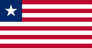
Ivory Coast–Liberia border
A river border that runs along the Liberian bank of the Cavalla and the Nuon from the Atlantic to the Nimba mountains, set by France and Liberia in 1892 and 1907. In the 2000s, crises in Ivory Coast sent refugees across it into Liberia, and UN convoys and ferries later brought them home.
Written from cited sourcesLast checked 29 September 2026Suggest a correction
See it on the globe:Ivory Coast →Liberia →
France and Liberia
Freed slaves sent by the American Colonization Society landed at the site of Monrovia in 1822, and Liberia became an independent republic in 1847. France secured most of the Ivory Coast shore through treaties with local rulers in 1842–44. A Franco-Liberian convention of 8 December 1892 ran the boundary up the Cavalla and then along theoretical lines of latitude and longitude.[1]
In 1907 the two sides agreed that those lines could not be applied on the ground and redrew the border along natural features: the right bank of the Nuon to the Cavalla, and the right bank of the Cavalla to the sea. Today the line follows the Liberian bank of the Cavalla for about 305 miles and the Nuon for 115 miles up to the Nimba Range.[1]
“The right bank of the Cavally River to the sea.”[1]
Refugees across the river
When violence broke out in Ivory Coast in November 2004, more than 1,300 Ivorians fled across the border into Liberia’s Nimba County, which was itself emerging from 14 years of civil strife.[2]
UNHCR began a programme to repatriate Ivorian refugees from Liberia in 2011. Returns were interrupted by the killing of seven UN peacekeepers on the Ivorian side of the border in 2012 and by attacks on villages in 2013; refugees were ferried across the rivers when rains flooded the roads. By November 2013 Liberia still hosted nearly 58,000 Ivorian refugees.[3]
Timeline
1847
Liberian independence
Liberia becomes an independent republic.[1]
18928 December 1892
Franco-Liberian convention
A first line is drawn.[1]
190718 September 1907
Natural boundary
The line moves to the Nuon and Cavalla.[1]
2004
Refugees flee
Ivorians cross into Nimba County.[2]
2011
Repatriation begins
UNHCR starts taking Ivorian refugees home.[3]
More borders
Ivory Coast
Sources
- [1]International Boundary Study No. 132: Cote D’Ivoire – Liberia Boundary · US Department of State, Office of the Geographer · 2 January 1973
- [2]Côte d’Ivoire: flight to Liberia, planning for outflow · UNHCR · 9 November 2004
- [3]UNHCR exceeds 2013 repatriation target for Ivorian refugees in Liberia · UNHCR · 27 November 2013
Map geometry from Natural Earth via world-atlas. See credits.