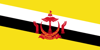
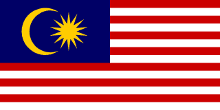
Brunei–Malaysia border
A border that surrounds Brunei on land and cuts it in two, because the Limbang valley between its halves went to Sarawak in 1890. The two countries settled their sea boundary in 2009, but whether Brunei gave up Limbang is still disputed, and marking the land line is due to take until 2034.
Written from cited sourcesLast checked 28 September 2026Suggest a correction
See it on the globe:Brunei →Malaysia →
Limbang
Limbang was once part of the Brunei sultanate, providing revenue, food and river access. After a rebellion in Limbang against the sultanate in 1884, Charles Brooke, the rajah of Sarawak, annexed it in March 1890, saying its chiefs preferred Sarawak. Britain gave tacit approval despite the sultan’s protests and declared the matter closed in 1895. According to the Bruneian journalist Malai Hassan Othman, the sultan refused compensation and never agreed.[1]
The annexation split Brunei in two, cutting off its eastern district of Temburong. People from Temburong who work in the capital, Bandar Seri Begawan, cross into Malaysia and back into Brunei every day, while Limbang residents pass through Brunei to reach the rest of Sarawak.[1]
The 2009 letters
In March 2009 Brunei’s sultan and Malaysia’s prime minister, Abdullah Ahmad Badawi, signed an Exchange of Letters. It settled the sea boundaries, set up a commercial arrangement area for joint oil and gas development, recognised Brunei’s claim to Louisa Reef and created a framework for surveying the land border.[1]
On 16 March Abdullah announced that Brunei had dropped its claim to Limbang, as part of resolving the two countries’ land and sea disputes.[2] Brunei’s second minister of foreign affairs, Lim Jock Seng, publicly denied that Limbang had been discussed, saying the talks concerned boundary demarcation in general.[1]
“Brunei has officially dropped its long-standing claim over Sarawak’s Limbang district”[2]
Watershed by watershed
At their annual consultation on 21 August 2026, Sultan Hassanal Bolkiah and Prime Minister Anwar Ibrahim called the 2009 letters and a 2012 boundary memorandum binding, and directed that the sector covering the Limbang area, Sector F–G, be settled solely by a jointly determined watershed and surveyed by 31 May 2027. Anwar said about 265 km, roughly half the land border, had been demarcated, and the whole line should be surveyed by 2034.[1]
Timeline
1890March 1890
Limbang annexed
Sarawak takes Limbang, splitting Brunei in two.[1]
1895
Britain closes the matter
Brunei does not accept the decision.[1]
2009March 2009
Exchange of Letters
Sea boundaries are settled; the Limbang claim is disputed.[1][2]
202621 August 2026
Watershed deal
Leaders set dates to finish the Limbang sector and the whole border.[1]
Sources
- [1]The Limbang Question Lingers On · The Diplomat · 2026-09
- [2]Brunei drops claim over Limbang in Sarawak · The Star (Malaysia) · 16 March 2009
Map geometry from Natural Earth via world-atlas. See credits.