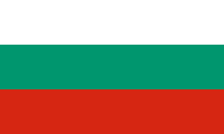

Bulgaria–Greece border
A mountain border along the Rhodope from Mount Tumba to the Maritsa (Evros) River. After the Balkan Wars Bulgaria briefly held a strip of Aegean coast; the 1919 peace treaty took it away and drew the present line, and tens of thousands of Bulgarians and Greeks moved across it. Since 2025 there are no passport checks on it.
Written from cited sourcesLast checked 29 September 2026Suggest a correction
See it on the globe:Bulgaria →Greece →
Bulgaria’s lost coast
After the Second Balkan War of 1913, in which Bulgaria fought its former allies, the Treaty of Bucharest left it only a strip of about 70 miles of Aegean coast between the Mesta and Maritsa rivers. Bulgaria sided with the Central Powers in 1915 and was defeated in 1918. The Treaty of Neuilly of 27 November 1919 drew the present border and cut Bulgaria off from the Aegean; offered transit rights through the port of Dedeagatch (Alexandroupolis) in 1923, Bulgaria rejected them as inadequate.[1]
The line runs along the Belasica ridge, across the Struma and Mesta, along the watershed of the Rhodope, then north to the Maritsa (Evros), which it follows to Turkey. Under a convention signed with the Neuilly treaty, 53,000 Bulgarians left Greece, on top of 39,000 who had gone earlier, and 46,000 Greeks, nearly the whole Greek minority, left Bulgaria. The 1947 peace treaty confirmed the border.[1]
“all territorial claims are excluded forever”[1]
No more checks
Bulgaria joined the EU in 2007 but its land borders stayed outside the Schengen area, largely because of Austrian objections over irregular migration. At midnight on 1 January 2025 identification checks at its land borders with other EU members, including Greece, ended.[2]
Timeline
More borders
Sources
- [1]International Boundary Study No. 56: Bulgaria – Greece Boundary · US Department of State, Office of the Geographer · 1 October 1965
- [2]Romania, Bulgaria join borderless Schengen zone after 13-year wait · Al Jazeera (news agencies) · 1 January 2025
Map geometry from Natural Earth via world-atlas. See credits.