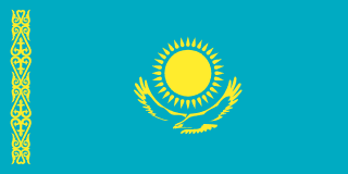
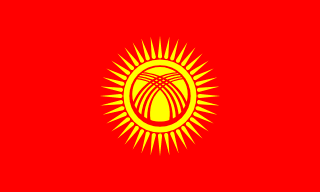
Kazakhstan–Kyrgyzstan border
A long mountain and steppe border just north of Bishkek, first drawn in Moscow’s 1924 carve-up of Soviet Central Asia and agreed between the two independent states in 2001. The line itself is settled, but Kazakhstan has repeatedly slowed or shut the crossings, in 2010 after Kyrgyzstan’s revolution and since 2017 in rows over smuggling, leaving trucks queueing for days.
Written from cited sourcesLast checked 6 October 2026Suggest a correction
See it on the globe:Kazakhstan →Kyrgyzstan →
Splitting Turkestan
Before 1924 there was no border here at all. Most of the land on both sides lay in the Soviet Turkestan republic, and on 12 June 1924 the Communist Party leadership decided to split it into national units; the decision became law that October.[1] Borders were drawn around whichever ethnic group was largest in each area, with little regard for the nomadic and semi-nomadic peoples who moved between them.[5]
The Kazakh autonomous republic, which already existed, gained the Syr Darya region and the northern part of Semirechye, bringing most Kazakh-inhabited lands, including Almaty and Shymkent, together for the first time.[1] The Kyrgyz, then called Kara-Kirghiz, got an autonomous oblast inside Soviet Russia on 14 October 1924. It became an autonomous republic in 1926, and both it and Kazakhstan became full Soviet republics in 1936,[5] when the line between them became a border between republics.
Settled on paper
Unlike the tangled borders of the Fergana Valley, Kazakhstan settled its borders with its Central Asian neighbours early; its delimitation agreement with Kyrgyzstan was signed in December 2001.[2]
After the uprising of 7 April 2010 in Kyrgyzstan, Kazakhstan closed the border, and Kyrgyz leaders warned of an economic blockade. Kazakhstan reopened it on 20 May 2010, citing the difficult situation in Kyrgyzstan, but kept checks tight, pointing to smuggling of weapons and drugs. The reopening came hours after Kyrgyzstan diverted the Talas river, a source of irrigation water for southern Kazakhstan, and then turned it back on.[4]
Queues at the checkpoint
In 2017 relations soured after Kyrgyzstan’s outgoing president Almazbek Atambayev accused Kazakhstan of meddling in Kyrgyzstan’s presidential election. Kazakhstan tightened border checks and restricted Kyrgyz dairy imports, and its prime minister accused Kyrgyzstan of being a conduit for Chinese contraband that cost the Eurasian Economic Union billions.[6]
Queues of trucks have built up repeatedly since then. By early 2020 drivers were waiting days at the Ak-Tilek checkpoint, blaming slow Kazakh customs inspections; Kyrgyzstan appealed to the World Trade Organization and the Eurasian Economic Commission, while Kazakhstan accused Bishkek of turning a blind eye to smuggling from China.[3]
“I’ve been waiting here for three days without sleep. The moment you go to sleep, somebody passes you.”[3]
Timeline
192414 October 1924
Kara-Kirghiz oblast
Moscow carves a Kyrgyz unit out of Turkestan; Kazakhstan takes the north of Semirechye.[5][1]
1936
Union republics
Kazakhstan and Kyrgyzstan become full Soviet republics.[5]
2001December 2001
Delimitation agreement
The border is agreed on paper.[2]
201020 May 2010
Border reopened
Kazakhstan lifts the closure imposed after the April uprising.[4]
2017
Contraband row
Kazakhstan tightens checks and restricts Kyrgyz imports.[6]
2020
Truck queues
Drivers wait days at Ak-Tilek.[3]
More borders
Sources
- [1]A Hundred Years of the Reunification of Kazakhs in the Kazakh ASSR · Qalam (Nikolay Uskov) · 12 June 2024
- [2]Current State of Border Issues in Central Asia · Eurasian Research Institute · 2 February 2018
- [3]Kyrgyzstan, Kazakhstan border crises complicated by mutual distrust · Eurasianet · 6 February 2020
- [4]Under [Water] Pressure, “Fraternal” Kazakhstan Reopens Kyrgyzstan Border · Eurasianet · 20 May 2010
- [5]How Soviet Borders Divided Central Asia · e-history.kz (History of Kazakhstan portal) · 31 August 2026
Summarises Shokhruz Sharipov’s study of the 1920s–50s delimitation.
- [6]Kazakhstan, Kyrgyzstan Bicker Over Contraband · Eurasianet · 3 November 2017
Map geometry from Natural Earth via world-atlas. See credits.