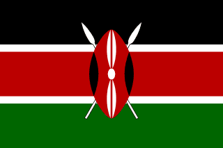
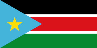
Kenya–South Sudan border
A short border with a long argument attached: the Ilemi Triangle, a stretch of dry-season pasture that British officials kept redrawing with red, green and blue lines. Kenya administers it, but its limits have never been agreed.
Written from cited sourcesLast checked 30 September 2026Suggest a correction
See it on the globe:Kenya →South Sudan →
Pasture, not territory
The Ilemi Triangle is a remote piece of land where Kenya, South Sudan and Ethiopia meet. Five herding peoples, the Turkana, Didinga, Toposa, Nyangatom and Dassanech, bring their animals there in the dry season, and its pastures have caused repeated conflict between them. In 2003 it had no infrastructure except a Kenyan frontier post.[2]
The line began in 1914 as part of Uganda’s northern border, drawn by an Order of the Secretary of State. When Uganda’s Rudolf Province was transferred to Kenya on 1 February 1926, that line automatically became the border between Kenya and the Anglo-Egyptian Sudan.[1]
Red, green and blue lines
In late 1931 the administrators of Sudan’s Mongalla province and Kenya’s Turkana district agreed that the Turkana pastures lay within an area marked by a ‘Red Line’. In 1932 a ‘Green Line’ extended it north-east so the Turkana could share water holes with their neighbours. In 1938 a joint survey drew the ‘Wakefield Line’ to include hills that protected the Turkana from raiders.[2]
In 1944 Britain’s Foreign Office drew a ‘Blue Line’ further west, enlarging the triangle, and in 1950 Sudan set out its own ‘Sudanese Patrol Line’ further west still. Sudan never wanted to pay for administering the area, and at times considered trading it to Ethiopia for the Baro salient. The dispute outlasted independence for Kenya in 1963 and Sudan in 1956, and in 2011 the Sudanese side of the line passed to South Sudan.[2]
Timeline
1914
Uganda’s line
The boundary is set as part of Uganda’s northern border.[1]
19261 February 1926
Transfer to Kenya
The line becomes the Sudan–Kenya border.[1]
1931
Red Line
Local administrators agree the limit of Turkana pastures.[2]
1938
Wakefield Line
A joint survey extends the Kenyan side.[2]
1950
Sudanese Patrol Line
Sudan sets out its own line further west.[2]
More borders
Sources
- [1]International Boundary Study No. 104: Sudan – Uganda Boundary · US Department of State, Office of the Geographer · 1 October 1970
- [2]Delimitation of the Elastic Ilemi Triangle: Pastoral Conflicts and Official Indifference in the Horn of Africa · Nene Mburu, African Studies Quarterly 7(1) · 2003
Map geometry from Natural Earth via world-atlas. See credits.