Saint Martin, one island, two countries
A Caribbean island of 88 km² split since 1648: the north is French, the south Dutch. There are no border checks between them, yet the two halves have different governments and languages, and only the French half is in the European Union.
Written from cited sourcesLast checked 13 October 2026Suggest a correction
See it on the globe: Saint Martin →
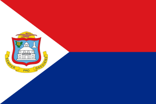 Sint Maarten →
 France →
 Netherlands →
Salt, Spain and a treaty
Columbus sighted the island on 11 November 1493, St Martin of Tours’ feast day, and named it after him. Its natural salt lakes, valuable in Europe, made it worth fighting over, and it changed hands between the Dutch and the Spanish several times.[1] Spain sent a fleet in 1638 to drive out the Dutch settlers and left a garrison, which gave up the island about ten years later.[3]
On 23 March 1648 France and the Netherlands split the island with a treaty signed on Concordia Hill, which let people and goods move freely between the two parts.[3] A local legend says the line was set where a French runner and a Dutch runner, starting from opposite ends, met, and that the French half is bigger because its runner was faster. The tourist office itself calls it a legend that never ends.[3]
Two halves, two paths
The Dutch south joined the Dutch West Indies in 1828 and became part of the Netherlands Antilles in 1954. When the Antilles were dissolved on 10 October 2010, Sint Maarten became a country within the Kingdom of the Netherlands, like Aruba. It runs its own internal affairs with a 15-seat parliament and a prime minister; the Netherlands handles defence and foreign relations. Its official languages are English and Dutch.[2]
The French north was for nearly two centuries a commune of Guadeloupe.[4] On 7 December 2003, 76.3% of voters chose a status of its own, and an organic law of 21 February 2007 made Saint-Martin a separate overseas collectivity of France.[4][1] French is its official language, and English is widely spoken.[1]
In the EU, and not
The split runs through Europe’s rules too. Saint-Martin is one of the EU’s outermost regions, a full part of the Union like Guadeloupe or the Canary Islands.[5] Sint Maarten is one of the EU’s overseas countries and territories, which are associated with the Union but not part of it or its single market.[6]
Shops on both sides take euros and US dollars.[3] The Dutch side also has its own currency: on 31 March 2025 it swapped the Netherlands Antillean guilder, which it shares with Curaçao in a monetary union, for a new Caribbean guilder pegged to the US dollar.[7]
A border you barely see
There are no border posts and no identity checks. Flags, welcome signs and a few boundary markers show where the line is, and most road crossings aren’t marked at all, so you can cross it several times a day without noticing. An obelisk put up in 1948 marks 300 years of peaceful sharing.[3]
Timeline
149311 November 1493
Columbus
Columbus sights the island and names it for St Martin.[1]
1638
Spanish garrison
Spain drives out the Dutch settlers.[3]
164823 March 1648
Treaty of Concordia
France and the Netherlands split the island.[3]
1828
Dutch West Indies
The Dutch half joins the Dutch West Indies.[2]
1948
Obelisk
A monument marks 300 years of sharing.[3]
1954
Netherlands Antilles
Sint Maarten becomes part of the new Netherlands Antilles.[2]
20037 December 2003
French side votes
76.3% of voters back a separate status.[4]
200721 February 2007
Collectivity
Saint-Martin leaves Guadeloupe as its own collectivity.[4]
201010 October 2010
Country Sint Maarten
The Antilles are dissolved and Sint Maarten becomes a country.[2]
202531 March 2025
Caribbean guilder
The Dutch side’s new currency replaces the Antillean guilder.[7]
More map oddities
- Akrotiri and Dhekelia
- Andorra, the country with two princes
- Antarctica’s claims
- Baarle-Hertog and Baarle-Nassau
- Baikonur
- Baja California, one peninsula, two states
- Bir Tawil
- Borneo
- Brčko District
- Büsingen and Campione d’Italia
- Cabinda
- Ceuta and Melilla
- Doubly landlocked countries
- Guantánamo Bay
- Hong Kong
- Jungholz
- Kaliningrad
- Kazungula
- Lake Constance
- Liberland
- Llívia
- Macau
- Madha and Nahwa
- Märket
- Molossia
- Musandam
- Neum
- Neutral Moresnet
- Newfoundland, the country that joined Canada
- Oecusse
- Pheasant Island
- Point Roberts and the Northwest Angle
- Quintana Roo, the territory that kept disappearing
- Russian America
- Sealand
- Slowjamastan
- Svalbard
- Temburong
- The Cooch Behar enclaves
- The Cyprus Green Line
- The Diomede Islands
- The Fergana Valley enclaves
- The International Date Line
- The Isle of Man and the Channel Islands: not part of the UK
- The Order of Malta
- The Siliguri Corridor
- The Suwałki Gap
- The Vennbahn
- The world’s exclaves
- Treriksröset
- Tsushima, the island between Japan and Korea
- Vatican City
- When Western Australia voted to leave Australia
Sources
- [1]Saint Martin · Encyclopaedia Britannica
- [2]Sint Maarten · Encyclopaedia Britannica
- [3]A Symbolic Border on Saint Martin · Saint-Martin Tourist Office
- [4]Rapport d’information sur la collectivité d’outre-mer de Saint-Martin (no. 2128) · Assemblée nationale · 16 July 2014
- [5]Outermost regions · European Commission
- [6]Overseas Countries and Territories · European Commission
- [7]Curaçao and Sint Maarten implement the Caribbean guilder · Orbitax · 2025
- [8]Admin 0 – Countries, 1:10m · Natural Earth (via the world-atlas package)
The two halves’ outlines on the map.
Map geometry from Natural Earth via world-atlas. See credits.