Russian America
For most of a century Russia had a colony in North America, run by a fur-trading company with its own flag. From Kodiak and Sitka it hunted sea otters along the coast of Alaska, founded a fort in California and, briefly, flew the Russian flag over a fort in Hawaii. It ended when Russia sold Alaska in 1867.
Written from cited sourcesLast checked 28 September 2026Suggest a correction
See it on the globe: United States →
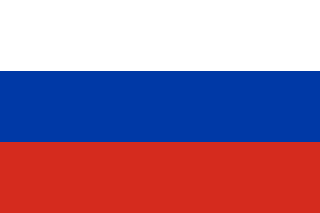 Russia →
Furs across the strait
In 1728 Vitus Bering, a Dane in Peter the Great’s service, sailed through the strait now named after him. On his second voyage, in 1741, he reached the Gulf of Alaska and the Aleutians; he died on the way back, but survivors brought news of the rich furs there.[1]
Merchants followed. The company of Grigory Shelikhov and Ivan Golikov, formed in 1781, set out to found colonies on the American coast, and from 1791 Aleksandr Baranov ran its operations from Kodiak Island.[2]
A company that governed
In 1799 Tsar Paul I gave the merged fur companies a 20-year charter as the Russian-American Company, with exclusive trading rights in North America north of 55° and responsibility for governing the Russian settlements there.[2] It had its own flag, Russia’s white, blue and red with the imperial eagle and the company’s name on a ribbon; it is in the Flags of former countries gallery.
Baranov founded a fort near present-day Sitka in 1799, but the Tlingit destroyed it in 1802. In 1804 he moved the company’s headquarters there from Kodiak as New Archangel, after a battle with the Tlingit.[3] Agreements with the United States, Spain and Britain around 1824 confirmed the company’s hold on the coast north of 54°40′.[2]
California and Hawaii
As sea otters grew scarce in Alaska, the company looked south. In 1812 Ivan Kuskov arrived on the northern California coast with 25 Russians and 80 Unangan (Aleuts) and built Fort Ross, 145 km north of San Francisco, to hunt otters and grow food for Alaska.[5] It was the southernmost Russian colony in North America, on the homeland of the Kashia Pomo; the company sold it in 1841.[4][5]
In Hawaii a company agent, Georg Anton Schäffer, went far beyond his orders. He promised the Kauai chief Kaumualiʻi Russian protection against Kamehameha I, and Hawaiian workers built a fort on the Waimea River that for a time flew the Russian flag. St Petersburg rejected the deal, and in 1817 Schäffer had to flee.[7]
The end
Revenues fell as rivalry with Britain grew, and Russia let the company’s charter lapse in 1862.[2] Five years later it sold Alaska to the United States, and on 18 October 1867 the flags were changed at Sitka.[6][3]
Timeline
1741
Bering reaches Alaska
Bering’s second voyage reaches the Gulf of Alaska.[1]
1791
Baranov at Kodiak
Aleksandr Baranov takes charge of the company’s operations.[2]
1799
Company chartered
Paul I charters the Russian-American Company.[2]
1804
New Archangel
The company’s headquarters move to what is now Sitka.[3]
1812
Fort Ross
The company founds a colony in California.[5]
1817
Out of Hawaii
Schäffer flees Kauai after St Petersburg rejects his treaty.[7]
1841
Fort Ross sold
The company sells its California colony.[5]
186718 October 1867
Transfer
Russian America becomes American at Sitka.[3]
More map oddities
- Antarctica’s claims
- Baarle-Hertog and Baarle-Nassau
- Bir Tawil
- Ceuta and Melilla
- Guantánamo Bay
- Hong Kong
- Kaliningrad
- Lake Constance
- Liberland
- Llívia
- Macau
- Madha and Nahwa
- Molossia
- Point Roberts and the Northwest Angle
- Sealand
- Slowjamastan
- Svalbard
- The Cooch Behar enclaves
- The Fergana Valley enclaves
- The Siliguri Corridor
- Vatican City
Sources
- [1]Vitus Bering · Encyclopaedia Britannica
- [2]Russian-American Company · Encyclopaedia Britannica
- [3]Sitka · Encyclopaedia Britannica
- [4]Fort Ross State Historic Park · California State Parks
- [5]Fort Ross · Encyclopaedia Britannica
- [6]Alaska Purchase · Encyclopaedia Britannica
- [7]Russian Fort / Fort Elizabeth · US National Park Service
- [8]Admin 0 – Countries, 1:50m · Natural Earth (via the world-atlas package)
Alaska’s outline on the map.
Map geometry from Natural Earth via world-atlas. See credits.