Åland
Swedish-speaking islands between Sweden and Finland that wanted to join Sweden in 1917. The League of Nations left them in Finland in 1921 with a guaranteed autonomy, and they have been demilitarized since 1856.
Written from cited sourcesLast checked 28 September 2026Suggest a correction
See it on the globe: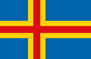 Åland Islands →
 Finland →
 Sweden →
Islands at the mouth of the Gulf of Bothnia
Åland is an archipelago at the entrance to the Gulf of Bothnia, 40 km from the Swedish coast. It has about 35 inhabited islands and some 6,500 uninhabited ones. The main island holds about 90% of the people and Mariehamn, the only town.[1]
Swedish missionaries brought Christianity in the 12th century.[1] When Sweden lost Finland to Russia in the war of 1808–09, the islands went with it into the Grand Duchy of Finland.[2] Russia had agreed not to fortify them, but in the 1830s it built the fortress of Bomarsund, which British and French troops destroyed in 1854 during the Crimean War. The Åland Convention of 1856 said the islands would never be fortified again.[1]
The Åland question
When Finland declared independence in 1917, the Ålanders claimed the right to self-determination and asked to join Sweden. Finland offered autonomy in 1920 but refused to let them go.[1] The Ålanders at first rejected Finland’s Autonomy Act, and the dispute went to the League of Nations.[2]
In June 1921 the League’s Council decided that Finland should have sovereignty over the islands, and Finland undertook to guarantee their Swedish language, culture and local customs. The Council also asked for a treaty confirming the demilitarization of 1856 and adding neutralization.[2] Åland’s first parliament met on 9 June 1922, still celebrated as Autonomy Day.[3]
How the autonomy works
The Autonomy Act of 1920 was replaced in 1951, and the present Act came into force on 1 January 1993. Finland’s parliament passed it in the same way as a constitutional change, and with the consent of Åland’s parliament.[2] The Lagting makes laws on matters such as the economy, education, transport and health care, and appoints the Government of Åland. Ålanders also elect one member of Finland’s parliament.[1][3]
Swedish is the only official language, in state and municipal offices as well as Åland’s own.[2] A kind of regional citizenship, the right of domicile, is needed to vote in Åland’s elections, to stand for office and to buy land freely. Finnish citizens can apply after living on the islands for five years if they speak good Swedish.[2] Åland has its own flag since 1954, its own stamps since 1 March 1984, and its own car plates; its people are exempt from Finnish conscription.[3]
“The official language of Åland shall be Swedish. The language used in State administration, Åland administration and municipal administration shall be Swedish.”[2]
Timeline
1809
To Russia
1854
Bomarsund destroyed
British and French troops destroy the Russian fortress.[1]
1856
Demilitarized
The Åland Convention bans fortifications.[1]
1917
Ask to join Sweden
As Finland becomes independent, Ålanders seek union with Sweden.[1]
1921
League of Nations
The League leaves Åland in Finland with guaranteed autonomy.[2][1]
19229 June 1922
First parliament
Åland’s parliament meets for the first time.[3]
1954
Own flag
Åland adopts its blue, yellow and red flag.[3]
19841 March 1984
Own stamps
Åland issues its first stamps.[3]
19931 January 1993
Current Act
The present Autonomy Act comes into force.[2]
More autonomous regions
Sources
- [1]Åland Islands · Encyclopaedia Britannica
- [2]Act on the Autonomy of Åland (1991/1144), unofficial English translation · Finnish Ministry of Justice, via UN Peacemaker
The translator’s preface covers 1809–1993.
- [3]Own flag, stamps and legislation · aland.com (Vibb)
Map geometry from Natural Earth via world-atlas. See credits.