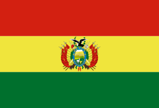
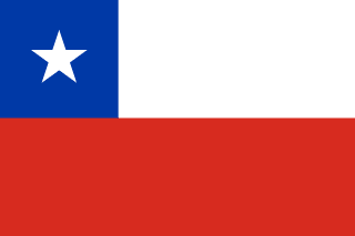
Bolivia–Chile border
A high Andean line of straight segments between volcano peaks, set in 1904 after Chile took Bolivia’s entire coast in the War of the Pacific. Bolivia has wanted a way back to the sea ever since, and in 2018 lost its case at the World Court.
Written from cited sourcesLast checked 28 September 2026Suggest a correction
See it on the globe:Bolivia →Chile →
When Bolivia had a coast
At independence in 1825, Bolivia claimed the coast from the Andes to the Pacific between the Río Salado and the Río Loa, part of the Atacama Desert. When nitrate was found there, Chile made claims to the desert too. An 1866 treaty set the boundary at latitude 24°S, and another in 1872 confirmed it.[1]
In 1878 Bolivia put a tax on a nitrate company that by then was Chilean-owned, which Chile said broke the 1866 treaty. Chile occupied the Bolivian coast in February 1879 and on 5 April declared war on Bolivia and its ally Peru: the War of the Pacific.[1] The truce of Valparaíso on 4 April 1884 left Chile running Bolivia’s coast, and Bolivia lost its outlet to the Pacific.[1]
The 1904 treaty
A treaty of 18 May 1895 confirmed the loss, and a second one that day promised Bolivia Tacna and Arica if Chile obtained them, or else a small port south of Arica. The peace treaty of 20 October 1904 recognised Chilean sovereignty over the former Bolivian coast. In return Chile granted Bolivia commercial transit through its territory and ports in perpetuity.[1] A railway from Arica to La Paz, finished in 1913, gave Bolivia a second rail line to the sea.[1]
The 1904 treaty drew the border through 96 numbered points, mostly straight lines between Andean summits such as Licancabur, Ollagüe and Olca. A 1907 protocol adjusted it so the Collaguasi railway stayed in Chile, though it was not ratified until 31 years later.[1] The frontier climbs from 13,000 feet at the Peru tripoint over peaks above 19,000 feet, and few roads cross it.[1]
“From the highest peak of Cerro Zapaleri (1), in a straight line to the highest point (2) of the ridge going toward the south of the Cerros de Guayaques”[1]
The sea question
Bolivia kept asking for a sovereign outlet to the sea. At Charaña on 8 February 1975, the two presidents agreed to talk.[3] In December 1975 Chile offered a strip of land north of Arica, running along the border with Peru to the coast, in exchange for an equal area of Bolivian territory.[2] The talks stalled over the exchange and over Peru’s proposal for a zone of shared sovereignty, and on 17 March 1978 Bolivia suspended diplomatic relations.[2]
Bolivia then asked the International Court of Justice to rule that Chile had to negotiate a sovereign access to the Pacific. On 1 October 2018 the court found, by twelve votes to three, that Chile had never taken on such a legal obligation, whether at Charaña or in any of the other exchanges Bolivia cited.[3] The court noted that Bolivia had not asked it to declare a right to the sea itself.[3]
Water across the line
Rivers that cross the border have caused their own disputes. From 1962 Chile diverted water from the Río Lauca, which rises in Chile and flows into Bolivia. Bolivia threatened to take the matter to the Organization of American States, which asked both governments to settle it peacefully.[1]
The Silala rises from springs in Bolivia, 0.5 to 3 km from the border, and flows into Chile. Its water has been piped to Antofagasta since the early 1900s. Chile took Bolivia to the ICJ in 2016, and by the court’s judgment of 1 December 2022 both sides agreed the Silala is an international watercourse that each is entitled to use equitably and reasonably.[4]
Timeline
186610 August 1866
Line at 24°S
Bolivia and Chile set their desert border at latitude 24°S.[1]
18795 April 1879
War of the Pacific
Chile declares war on Bolivia and Peru.[1]
18844 April 1884
Truce
Chile takes over Bolivia’s coast.[1]
190420 October 1904
Peace treaty
The border is drawn through 96 points, and Bolivia recognises Chile’s sovereignty over the coast.[1]
1913
Arica–La Paz railway
A second rail line links Bolivia to the Pacific.[1]
19758 February 1975
Charaña
The presidents agree to talks on Bolivia’s access to the sea.[3]
197817 March 1978
Relations suspended
Bolivia breaks off relations as the talks fail.[2]
20181 October 2018
ICJ ruling
The court finds Chile had no obligation to negotiate sovereign access.[3]
20221 December 2022
Silala judgment
The ICJ records both sides’ agreement that the Silala is an international river.[4]
More borders
Bolivia
Sources
- [1]International Boundary Study No. 67: Bolivia – Chile Boundary · US Department of State, Office of the Geographer · 15 March 1966
- [2]Obligation to Negotiate Access to the Pacific Ocean (Bolivia v. Chile), Judgment · International Court of Justice · 1 October 2018
- [3]Press release 2018/49: Obligation to Negotiate Access to the Pacific Ocean (Bolivia v. Chile) · International Court of Justice · 1 October 2018
- [4]Summary 2022/5: Dispute over the Status and Use of the Waters of the Silala (Chile v. Bolivia) · International Court of Justice · 1 December 2022
Map geometry from Natural Earth via world-atlas. See credits.