
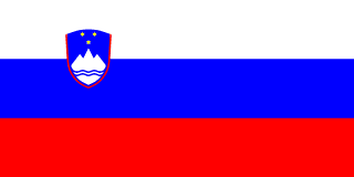
Hungary–Slovenia border
A short border through the low hills and plains around the Mura. The land on the Slovene side, Prekmurje, was part of Hungary for centuries until Yugoslav troops occupied it in August 1919 with Allied approval, and the Treaty of Trianon confirmed the line the next year.
Written from cited sourcesLast checked 30 September 2026Suggest a correction
See it on the globe:Hungary →Slovenia →
A deal in Paris
Slovene activists had long regarded the Slovene-speaking part of Hungary’s Vas and Zala counties as Slovene land, and the Yugoslav delegation claimed it at the Paris Peace Conference in 1919. The great powers were lukewarm until Hungary became a Soviet republic; in early July 1919 they added the area to the territory promised to Yugoslavia in exchange for its part in overthrowing the Budapest regime.[1]
Yugoslav troops crossed the border on 12 August 1919 and took over without a shot being fired. On 17 August, when civilian rule began, more than 20,000 people gathered in Beltinci to celebrate joining the rest of Slovenia.[2][1]
Liberation or annexation
Slovene politicians and newspapers described the takeover as liberation after a thousand years of Hungarian rule. The historian Jernej Kosi notes that no plebiscite was held and local people had no say, and that the decision owed more to strategy than to self-determination. The new administration replaced Hungarian officials and made Slovene the language of the schools.[1]
The Treaty of Trianon in 1920, which cost Hungary at least two-thirds of its former territory, confirmed the transfer. Apart from a short interruption during the Second World War, Prekmurje has been under Slovene administration ever since.[3][1]
“Nothing will ever be the same.”[1]
Timeline
More borders
Sources
- [1]Summer of 1919: A Radical, Irreversible, Liberating Break in Prekmurje/Muravidék? · Jernej Kosi, Hungarian Historical Review 9(1) · 2020
- [2]Centenary of Prekmurje rejoining its homeland (2019) · Bank of Slovenia · 2019
- [3]Treaty of Trianon · Encyclopaedia Britannica
Map geometry from Natural Earth via world-atlas. See credits.