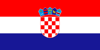
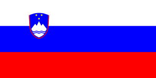
Croatia–Slovenia border
The border between two former Yugoslav republics, from Hungary to the Adriatic at the Bay of Piran. Inland it follows the old line between the Austrian and Hungarian halves of the Habsburg empire; in Istria it was only drawn after 1954. An international tribunal fixed it in 2017, but Croatia had walked out of the case and rejects the award, and the EU’s own court declined to step in.
Written from cited sourcesLast checked 6 October 2026Suggest a correction
See it on the globe:Croatia →Slovenia →
Two halves of an empire
Inland, this border is the edge of two very old units. The Marches of Carniola and Styria, now in Slovenia, were set up on the Holy Roman Empire’s eastern frontier in the 10th and 12th centuries; the Kingdom of Croatia, south and east of them, entered a union with Hungary in 1102, and both came under the Habsburgs in 1526–27. Habsburg Austria mapped every village for taxation, above all in the Franciscan cadastre of 1817–61.[3]
When the empire was split in 1867 into an Austrian half (Cisleithania) and a Hungarian half (Transleithania), Croatia-Slavonia belonged to the Hungarian side, while most Slovene lands were in the Austrian crown lands of Styria and Carniola and the Austrian Littoral. Much of today’s border is simply the line between those two halves.[3]
Istria after 1945
The coastal end is much newer. After the Second World War the north-west of Istria fell into Zone B of the Free Territory of Trieste, under Yugoslav military administration. When the territory was dissolved by the London Memorandum of 1954, Yugoslavia took over Zone B and split it between its republics: the Koper district went to Slovenia and the Buje district to Croatia.[3]
A border commission was set up in 1955 for those two districts, and after that the republics’ territories stayed essentially unchanged until 1991. But Yugoslavia’s constitutions mentioned the boundaries between its republics without ever describing them, and the two sides later disagreed about how they had been set, which is why the case went to arbitration.[3]
A bay with two names
When the two former Yugoslav republics became independent in 1991, they could not agree their border on land, and their sea boundary had never been drawn. The sharpest quarrel was over what Slovenia calls the Bay of Piran and Croatia the Bay of Savudrija/Piran: Slovenia claimed all of it, and Croatia wanted a median line.[1][2][4]
After years of failed talks, on 4 November 2009 the two countries signed an arbitration agreement, with the European Commission’s help. The tribunal was to decide the land and sea boundary, Slovenia’s “junction” to the high sea, and how the waters would be used.[2]
The 2017 award
In July 2015 recordings leaked of telephone calls between the Slovenian judge on the tribunal and Slovenia’s official representative to it. Croatia withdrew, saying the process had been compromised, and has said it does not consider the proceedings binding.[4][1]
The tribunal carried on and gave its final award on 29 June 2017. On land it fixed the line in more than twenty disputed areas, mostly following cadastral boundaries set by the Austrian Empire in the 1800s for tax purposes. It gave the larger part of the bay to Slovenia, adjusted the equidistance line at sea in Slovenia’s favour because of Cape Savudrija, and created a “junction area” through Croatia’s territorial sea where ships and aircraft heading to and from Slovenia have freedom of communication.[1][2]
“the equidistance line must be adjusted in favour of Slovenia”[1]
Stalemate
Slovenia says the award is final and binding and is implementing it on its side. In July 2018 it took Croatia to the EU Court of Justice, arguing that refusing the award broke EU law, and complaining that Croatian police escorted fishing boats in the contested waters.[2][4]
On 31 January 2020 the court ruled that it had no jurisdiction. Croatia’s prime minister, Andrej Plenković, called it a victory for Croatian arguments and again proposed bilateral talks; Slovenia’s foreign minister, Miro Cerar, said the ruling still made clear that both states must comply with the award.[4]
Both countries are in the EU’s Schengen area. Slovenia reintroduced checks on its border with Croatia on 21 October 2023, citing an increased terrorist threat, and lifted them on 11 June 2026.[5]
Timeline
1102
Croatia joins Hungary
The Kingdom of Croatia enters a union with Hungary; the Slovene lands are Austrian marches.[3]
1867
Austria-Hungary
Croatia-Slavonia falls in the Hungarian half, the Slovene lands in the Austrian half.[3]
19545 October 1954
London Memorandum
Zone B of Trieste is split: Koper to Slovenia, Buje to Croatia.[3]
1955
Border commission
A commission is set up for the line between the Koper and Buje districts.[3]
1991
Independence
Slovenia and Croatia become independent with their border unsettled.[1][2]
20094 November 2009
Arbitration agreement
The two countries agree to go to a tribunal.[2]
2015
Croatia withdraws
Leaked calls lead Croatia to quit the case.[4]
201729 June 2017
Final award
The tribunal gives most of the bay to Slovenia.[1]
202031 January 2020
EU Court declines
The court rules it has no jurisdiction.[4]
202611 June 2026
Checks lifted
Slovenia ends its temporary border controls.[5]
More borders
Sources
- [1]PCA Arbitral Tribunal Issues Final Award in Land and Maritime Dispute Between Croatia and Slovenia · American Society of International Law · 1 August 2017
- [2]Arbitration · Government of the Republic of Slovenia
- [3]Final Award, Arbitration between the Republic of Croatia and the Republic of Slovenia (PCA Case No. 2012-04) · Permanent Court of Arbitration · 29 June 2017
Historical background, paragraphs 10–33.
- [4]EU Court Denies Jurisdiction Over Slovenia-Croatia Border Dispute · Balkan Insight · 31 January 2020
- [5]Temporary control on the internal border · Government of the Republic of Slovenia
Map geometry from Natural Earth via world-atlas. See credits.