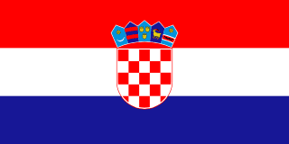
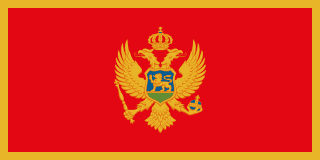
Croatia–Montenegro border
A short land border near Dubrovnik that has marked the end of Dubrovnik’s lands since 1699, when the city handed its neighbour Sutorina to the Ottomans. Its end at the Prevlaka peninsula, guarding the Bay of Kotor, was disputed after Yugoslavia broke up, and UN military observers watched over it for ten years until an interim deal in 2002.
Written from cited sourcesLast checked 6 October 2026Suggest a correction
See it on the globe:Croatia →Montenegro →
Dubrovnik’s edge
This border is older than either country. At the Peace of Karlowitz in 1699 the Republic of Ragusa (Dubrovnik) gave two strips of coast to the Ottomans, Neum to its north-west and Sutorina to its south-east, so that its Venetian rivals could not reach it by land.[3] From then on Cape Kobila marked the boundary between Ragusa’s Konavle district and Ottoman Sutorina.[1]
Prevlaka, a peninsula about 2.5 km long, is the southern tip of Konavle and of Dalmatia, and the northern arm of the headlands guarding the entrance to the Bay of Kotor. Austria, which took over Dalmatia, built a naval base in the bay in the 1850s and a fortress on Prevlaka’s Cape Oštra, linked by road to Cape Kobila.[1]
After the Second World War, when Yugoslavia’s republics were drawn on historical lines, Bosnia kept Neum but Sutorina was given to Montenegro, which for the first time in its history gained control of the Bay of Kotor.[1] Prevlaka stayed in Croatia, but the Yugoslav army valued it so highly that in 1955 it closed the peninsula to the public, confiscating land from some local people.[1]
A peninsula under UN watch
After Yugoslavia broke up, Croatia and the Federal Republic of Yugoslavia, of which Montenegro was then part, both claimed the strategically important Prevlaka peninsula. From 20 October 1992 UN military observers monitored its demilitarisation, first under UNPROFOR and then under UNCRO.[2]
From 1 February 1996 the task passed to a separate UN Mission of Observers in Prevlaka (UNMOP), with up to 28 observers and liaison teams in Dubrovnik and Herceg Novi. A Croatia–Yugoslavia normalisation agreement of 23 August 1996 provided for a negotiated settlement, but talks started only in 1998 and stopped when NATO began military action against Yugoslavia in March 1999.[2]
An interim deal
After new governments came to power in both countries in 2000, they set up a joint Interstate Diplomatic Commission in December 2001 to settle their border disputes. On 10 December 2002 they signed a protocol on an interim regime along their southern border, setting up a provisional cross-border arrangement on Prevlaka.[2]
The UN Secretary-General said an international monitoring mechanism was no longer needed, and UNMOP ended on 15 December 2002. He noted that settling the dispute itself remained the two countries’ responsibility.[2]
Timeline
1699
Sutorina ceded
Ragusa gives Sutorina to the Ottomans; Cape Kobila becomes the boundary.[3][1]
1850s
Austrian forts
Austria fortifies Prevlaka and the Bay of Kotor.[1]
After 1945
Sutorina to Montenegro
In Tito’s Yugoslavia, Montenegro gains Sutorina and the Bay of Kotor.[1]
1955
Peninsula closed
The Yugoslav army bars the public from Prevlaka.[1]
199220 October 1992
UN observers arrive
UNPROFOR begins monitoring Prevlaka’s demilitarisation.[2]
19961 February 1996
UNMOP
A separate UN observer mission takes over.[2]
199623 August 1996
Normalisation agreement
Croatia and Yugoslavia agree to negotiate over Prevlaka.[2]
2001December 2001
Diplomatic commission
A joint commission is set up on border disputes.[2]
200210 December 2002
Interim protocol
A provisional regime is agreed for Prevlaka.[2]
200215 December 2002
UN mission ends
UNMOP’s mandate expires.[2]
More borders
Sources
- [1]The Maritime Boundaries of the Adriatic Sea · Gerald H. Blake and Duško Topalović, IBRU Maritime Briefing vol. 1 no. 8, Durham University · 1996
- [2]Prevlaka Peninsula – UNMOP – Background · United Nations (Department of Public Information) · 2002
- [3]Neum, le territoire qui échappe aux radars de l’Histoire · Slate.fr · 22 January 2019
In French; quotes the Harvard Bosnia specialist András Riedlmayer.
Map geometry from Natural Earth via world-atlas. See credits.