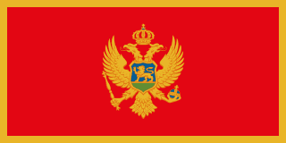
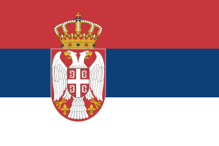
Montenegro–Serbia border
A mountain line through the old Sanjak region, inside one country from 1945 until Montenegro’s independence in 2006. The two countries set up a commission to delimit it in 2008, but its work stalled when Montenegro recognised Kosovo.
Written from cited sourcesLast checked 30 September 2026Suggest a correction
See it on the globe:Montenegro →Serbia →
From republics to states
The line between Serbia and Montenegro was first defined by the Treaty of London in 1913. From 1945 it was only an internal boundary: between two republics of socialist Yugoslavia, then of the Federal Republic of Yugoslavia from 1991 and of the State Union of Serbia and Montenegro from 2003. Montenegro declared independence in June 2006, and Serbia recognised it 12 days later, on 15 June.[1]
The two countries set up a commission to delimit the border in 2008, but its work was halted when Montenegro recognised Kosovo’s independence. Serbia, which considers Kosovo its southern province, did not want to negotiate the border unless Kosovo was treated as part of Serbia, and it declared Montenegro’s ambassador persona non grata for about a year. In 2011 researchers found only one small disputed area, a forest between the municipalities of Pljevlja and Prijepolje.[1]
Living with a new border
Communities on the two sides have always been close: they speak the same language, intermarry, and farmers from Prijepolje sell in Pljevlja’s markets. After 2006 they had to use official crossings, sometimes going twice as far, and their produce had to pass inspections that had not existed when it counted as domestic goods.[1]
In March 2011 an interstate commission agreed on three road crossings and on checking passengers on the Belgrade–Bar railway without stopping the trains. The two police forces had signed a protocol on joint patrols against smuggling and illegal logging in 2009.[1]
In May 2019 Serbia, Montenegro and Bosnia and Herzegovina signed a protocol in Sarajevo fixing the point where their three borders meet.[2]
“My house is close to the border. I am used to walking free and now if I don’t cross the line at the border crossing they arrest me, give me a ticket.”[1]
Timeline
1913
Line first drawn
Serbia and Montenegro are given a common border by the Treaty of London.[1]
1945
One state
The line becomes a boundary between Yugoslav republics.[1]
200615 June 2006
Serbia recognises Montenegro
The border becomes international.[1]
2008
Commission stalls
Delimitation stops after Montenegro recognises Kosovo.[1]
20117 March 2011
Crossing agreements
Three road crossings and rail checks are agreed.[1]
More borders
Sources
- [1]Territorial and Border Demarcation Disputes in the Western Balkans. Case study: The Demarcation process between Serbia and Montenegro · Belgrade Centre for Security Policy · 2011-12
- [2]Tripoint border protocol signed between Serbia, Montenegro and BiH · European Western Balkans · 15 May 2019
Map geometry from Natural Earth via world-atlas. See credits.