Why San Marino is a country inside Italy
A hilltop commune that stayed self-governing while the rest of Italy was conquered, traded and finally unified around it. Its borders were set in 1463, and in 1797 it turned down Napoleon’s offer of more land.
Written from cited sourcesLast checked 26 September 2026Suggest a correction
See it on the globe: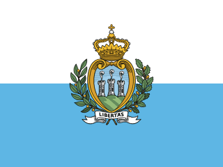 San Marino →
 Italy →
A commune on a mountain
Tradition says a stonemason named Marinus founded a Christian community on Mount Titano, and dates the first community of the republic to 301.[3] The first document to mention an organised community on the mountain is a parchment of 885.[3] By the 12th century San Marino was a commune with its own statutes and consuls.[1]
Its people governed themselves through the Arengo, an assembly of heads of families. In 1243 the first two consuls were appointed, and two Captains Regent have shared the office of head of state, for six months at a time, ever since.[3] It stayed independent of the bishops and lords around it largely because it was isolated and fortified. Against the Malatesta family of Rimini it had the protection of their rivals, the Montefeltro of Urbino.[1]
1463: the last change
Until 1463 San Marino was only Mount Titano. That year it joined an alliance against Sigismondo Pandolfo Malatesta, the lord of Rimini, who was defeated. Pope Pius II gave San Marino the towns of Fiorentino, Montegiardino and Serravalle, and later that year Faetano joined of its own accord. The country has been the same size ever since.[2]
It survived several threats: Cesare Borgia occupied it in 1503, and in the 18th century there were attempts to annex it to the Papal States.[1]
Saying no to the sea
When Napoleon invaded Italy he respected San Marino’s independence and, in 1797, offered to extend its territory.[1] The offer reached as far as the sea. The Sammarinese thanked him but turned it down, “satisfied with the borders they already had.”[3] The Congress of Vienna recognised San Marino’s independence in 1815.[1]
In 1849 Giuseppe Garibaldi, fighting to unify Italy, took refuge in San Marino with about 2,000 soldiers, and the authorities kept Austrian troops out while his men left.[3] When Italy became one state, San Marino stayed outside it: a series of treaties, the first in 1862, confirmed its independence.[1]
San Marino was neutral in the Second World War, but it was bombed by the British in 1944 and briefly occupied by both German and Allied troops.[1] UNESCO calls it the only surviving Italian city-state.[4]
“satisfied with the borders they already had”[3]
Timeline
301
Founding, by tradition
The first community of the republic forms on Mount Titano.[3]
885
First document
A parchment records an organised community on the mountain.[3]
1243
Two consuls
The first pair of what become the Captains Regent is appointed.[3]
1463
Borders set
Four towns join San Marino after the defeat of Sigismondo Malatesta.[2]
1503
Borgia occupation
Cesare Borgia occupies the republic.[1]
1797
Napoleon’s offer
San Marino declines extra territory reaching to the sea.[3][1]
1815
Congress of Vienna
The powers recognise San Marino’s independence.[1]
1849
Garibaldi
The republic shelters Garibaldi and about 2,000 soldiers.[3]
1862
Treaty with Italy
The first of several treaties confirms independence from the new Italian state.[1]
2008
World Heritage
Mount Titano and the historic centre are listed by UNESCO.[1][4]
More country shapes
Sources
- [1]San Marino · Encyclopaedia Britannica
- [2]San Marino · Encyclopedia.com (reference entries, including the Worldmark Encyclopedia of Nations)
- [3]History of San Marino · Visit San Marino (State Office of Tourism)
- [4]San Marino Historic Centre and Mount Titano · UNESCO World Heritage Centre
- [5]Admin 0 – Countries, 1:10m · Natural Earth (via the world-atlas package)
San Marino’s outline on the map.
Map geometry from Natural Earth via world-atlas. See credits.