Why Barbados stands apart
Barbados lies about 160 km east of the Lesser Antilles chain, out in the Atlantic. It isn’t a volcano like its neighbours: it is a pile of seabed mud and rock scraped up where the Atlantic floor slides under the Caribbean, lifted above the waves and capped with coral.
Written from cited sourcesLast checked 26 October 2026Suggest a correction
See it on the globe: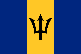 Barbados →
Out on its own
Barbados is roughly triangular, about 32 km from northwest to southeast and 25 km across at its widest. It lies about 160 km east of Saint Vincent and the Grenadines. It is usually counted with the Lesser Antilles, the chain of islands curving down to South America, but it isn’t part of it: its rocks are different, it is less mountainous, and it has fewer kinds of plants and animals.[1]
Its highest point, Mount Hillaby, reaches only 336 m. There are no real rivers or lakes, because rain sinks straight through the coral limestone into underground streams, which supply most of the island’s water.[1]
Seabed pushed up
The islands of the Lesser Antilles are volcanoes. They exist because the plate carrying the Atlantic floor is moving west and sliding under the Caribbean plate, at about two centimetres a year.[3]
As the Atlantic floor slides under, the mud and sand lying on it are scraped off and piled up against the edge of the Caribbean plate, like soil heaped on a shoe pushed into a pile of dirt. Geologists call such a pile an accretionary prism. Barbados is the part of this prism that has risen above the sea.[3] The Barbados prism is about 250 km wide and about 20 km thick, much of it sediment carried from South America, some of it by the Orinoco.[2]
The island is the highest point of this underwater ridge, and it rose above the waves only within the last million years or so. As it rose, coral grew over it in a series of terraces, and today coral covers about seven-eighths of the island.[2] The cap is up to 90 m thick. Only in the northeast, the Scotland District, has erosion stripped it away to show the older rocks beneath.[1]
First landfall
Lying east of the chain made Barbados the first Caribbean landfall for ships from Europe and Africa. Since the late 17th century it has been a link between Britain, the eastern Caribbean and South America.[1]
English settlers arrived in 1627, and from the 1640s the island grew sugar with the forced labour of enslaved Africans. Barbados was British without a break until independence on 30 November 1966, and in November 2021 it became a republic with its own president as head of state.[1]
Timeline
1627
English settlers
An English expedition arrives.[1]
1640s
Sugar
The economy turns to sugar, worked by enslaved Africans.[1]
1834
Slavery abolished
Slavery ends in Barbados.[1]
196630 November 1966
Independence
Barbados becomes independent.[1]
2021
Republic
Barbados replaces the British monarch with its own president.[1]
More country shapes
- Why Afghanistan has a panhandle
- Why Alaska is American
- Why Bolivia has no coast
- Why Canada’s border is so straight
- Why Chile is so long and thin
- Why Croatia is a crescent
- Why DR Congo has only a tiny coast
- Why Egypt reaches into Asia
- Why Indonesia stretches so far
- Why Italy is a boot
- Why Lesotho is a country inside South Africa
- Why Malawi wraps a lake
- Why Malaysia is in two halves
- Why Mongolia sits between two giants
- Why Namibia has a panhandle
- Why Norway is so long
- Why Oman comes in pieces
- Why Panama is an S
- Why Russia is so big
- Why San Marino is a country inside Italy
- Why so many US borders are straight
- Why Somalia is a 7
- Why Thailand looks like an elephant’s head
- Why The Gambia follows a river
- Why Togo is a thin strip
- Why Vietnam is an S
- Why Zambia is shaped like a butterfly
Sources
- [1]Barbados · Encyclopaedia Britannica
- [2]Barbados geology · Barbados Ministry of Energy, Business Development and Consumer Affairs
- [3]Leg 110 press release: the Lesser Antilles and the Barbados accretionary prism · Ocean Drilling Program, Texas A&M University
Map geometry from Natural Earth via world-atlas. See credits.